Importing an *.osm or *.pbf file
Setup
All examples and tutorials expect the OSM export files and resulting databases to be placed in the maps/ sub directory.
Say, you are using the nordrhein-westfalen.osm.pbf file from Geofabrik.
Download the file and rename it to nordrhein-westfalen.osm.pbf and place it in the maps sub directory:
  $ ls maps/
  nordrhein-westfalen.osm.pbf
In the following text nordrhein-westfalen is the paceholder for the
base name (without the suffix) of your import data file.
The examples and the build.sh in general assume that the Importer tool can be
called as ../Import/src/Import (from the maps sub directory). Depending on the
actual build process the resulting executable file name and its path may differ.
Using the bash script
Under Unix-like systems you can use the build.sh bash script
in the maps/ sub directory. Go into this directory and call the
script from there as follows:
$ ./build.sh nordrhein-westfalen.osm.pbf
The advantanges of the script are:
- it sources
nordrhein-westfalen.optif available and uses the variableoptionsas defined in this file to call the importer. This way you do not need to pass a long list of command line arguments every time. - it also sources
default.optfor the same reason, ifnordrhein-westfalen.optwas not found. - It passes the output of the importer to the output but also to the file
nordrhein-westfalen.txtin the same directory. So you can later take a look at this file for information you missed during the import.
Calling the importer by hand
You can also call the importer by hand. The minimum command line would be
  $ .../Import/src/Import  \
    --typefile ../stylesheets/map.ost \
    --destinationDirectory nordrhein-westfalen \
    nordrhein-westfalen.osm.pbf
Crop land and sea by data polygon
When you plan to use multiple maps (databases) or combine map with other sources (render it on top of online map for example), it is usefull to crop land and sea by some polygon. In case of data substract from Geofabrik, there are such polygons available in .poly format, for example nordrhein-westfalen.poly. You can use these polygon files directly as Import tool input beside standard data file.
  $ .../Import/src/Import  \
    --typefile ../stylesheets/map.ost \
    --destinationDirectory nordrhein-westfalen \
    --bounding-polygon nordrhein-westfalen.poly \
    nordrhein-westfalen.osm.pbf
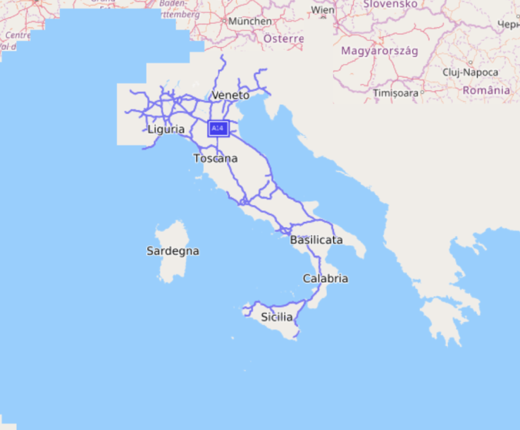
Italy without defined data polygon:
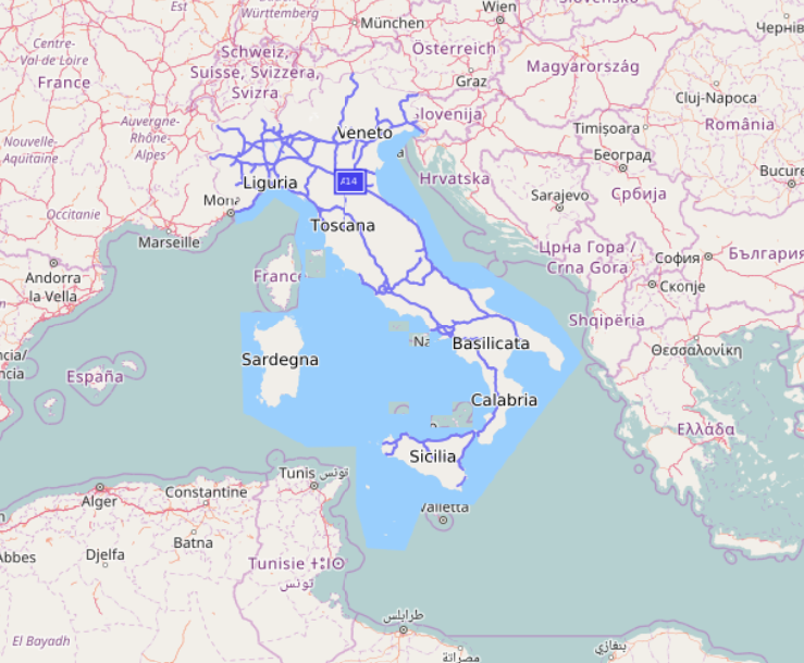
With data polygon:
Coastline troubleshooting
Import step evaluating coastlines and creating index for fast rendering of sea, land and unknown areas is sensitive for errors in coastline data.
When this index (water.idx) is incorrect, try folowing steps:
- Verify that your cropping polygon match the imported data.
- Check online Geofabric coastline inspector if all coastlines in imported area are connected, they are not crossing…
- Also check that there is no object with
natural=coastlinetag inside land area. Overpass-Turbo tool may be used for such check.
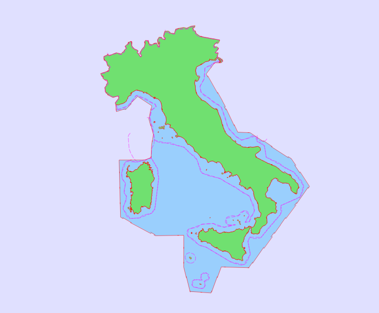
To inspect where is the problem, you can use specialized coastlines.oss stylesheet.
It displays just coastlines and areas (sea, land, unknown) from water.idx index
and country boundaries for simpler navigation.
Adding contour lines
Some years ago, Nasa released data from Shuttle Radar Topography Mission (http://en.wikipedia.org/wiki/SRTM) for public use. After some preprocessing can be those data used for creating nice maps with contour lines.

Required tools
Main tool for generating contour lines in OSM compatible format is Srtm2Osm.
Following steps are for Ubuntu 16.04.
sudo apt-get install wget unzip mono-runtime libmono-system-web-extensions4.0-cil
wget http://osm.michis-pla.net/code/Srtm2Osm-1.12.1.0.zip
unzip Srtm2Osm-1.12.1.0.zip
wget https://svn.openstreetmap.org/applications/utils/osm-extract/polygons/poly2bb.pl
chmod +x poly2bb.pl
Preprocessing
Like previous examples, this one is using nordrhein-westfalen region.
wget http://download.geofabrik.de/europe/germany/nordrhein-westfalen.poly
BBOX=`./poly2bb.pl nordrhein-westfalen.poly | awk -F '[= ]' '{print $8" "$2" "$6" "$4}'`

mono Srtm2Osm/Srtm2Osm.exe \
  -incrementid -firstnodeid $(( 1 << 33 )) -firstwayid $(( 1 << 33 )) \
  -cat 400 100 \
  -bounds1 $BBOX \
  -large \
  -maxwaynodes 256 \
  -o nordrhein-westfalen-contours.osm
Then, use both files nordrhein-westfalen-contours.osm and nordrhein-westfalen-latest.osm.pbf as input of Import tool.
Data notes
Srtm2Osm downloads SRTMv2 data set from Nasa automatically. This dataset has poor quality in mountainous areas like Alps.
For such areas is better to download elevation data from another source, for example
viewfinderpanoramas.org
that is using interpolations from more sources and it is free for non-commercial usage.
You just need to unpack downloaded archives and copy *.hgt
files into srtm/SrtmCache subdirectory (relative to directory where will be Srtm2Osm executed).
Resulting database
The importer uses a number of import steps (currently 24) to generate a custom database consisting of several data and index files.
Each step print itself with a header showing its running number, its name,
a short description of the task of the step, the dependend files and the
files generated. - announces a task, % prints the progress in relation
to the current task, WW introduces warnings and !! introduces errors.
...
+ Step #3 - CoordDataGenerator...
   Module description: Generate coord data file
   Module requires file 'rawcoords.dat'
   Module provides debugging file 'coord.dat'
 - Searching for duplicate coordinates...
   Searching for coordinates with page id >= 0
   % 27.42 (15078926/54994116)
   % 69.74 (38352393/54994116)
   Sorting coordinates
   Detect duplicates
   Loaded 54994116 coords (54994116/54994116)
   Found 358622 duplicate cordinates
 - Storing coordinates...
   Search for coordinates with page id >= -1844674407370
   % 91.30 (50207143/54994116)
   Sorting coordinates
   Write coordinates
   Loaded 54994116 coords (54994116/54994116)
 - Writing 2855797 index entries to disk...
   => 66.044s, RSS 2.8 GiB, VM 4.8 GiB
...
At the end of the import process the file size of the (major) resulting files is dumped:
...
     Overall 833.727s, RSS 3.6 GiB, VM 7.8 GiB
+ Summary...
   Mandatory files:
   File areaarea.idx: 5.9 MiB
   File areanode.idx: 3.4 MiB
   File areas.dat: 189.5 MiB
   File areaway.idx: 2.7 MiB
   File bounding.dat: 14 B
   File intersections.dat: 27.8 MiB
   File intersections.idx: 8.6 MiB
   File location.idx: 17.9 MiB
   File nodes.dat: 11.7 MiB
   File router.dat: 92.5 MiB
   File router.idx: 8.6 MiB
   File router2.dat: 1.2 KiB
   File types.dat: 24.9 KiB
   File water.idx: 496.2 KiB
   File ways.dat: 62.7 MiB
   => 431.8 MiB
   Optional files:
   File areasopt.dat: 1.9 MiB
   File textloc.dat: 2.4 MiB
   File textother.dat: 2.5 MiB
   File textpoi.dat: 1.3 MiB
   File textregion.dat: 107.6 KiB
   File waysopt.dat: 2.9 MiB
   => 11.1 MiB
   Import OK!
Optimizing the import process and resulting database
Default Import configuration should provide reasonable defaults for required memory during import, size of resulting database and required resources for rendering. But for some inputs may be too strict or too generous for various special usecases. It is beneficial to know Importer options and its impact.
-
Some huge area (wood, lake..) is missing on the map
When you are sure that such area is present in input data, inspect import log and look for object id (id of OSM relation). When you find this message:
Relation XXX references too many ways (YYY)consider increase default limit for relation members with argument by option--relMaxWays. This limit is here for performance reasons of redering, huge objects needs to be loaded in the device memory completely and its rendering is slow. But some object are just huge :-) Take a look to Finish lake “Inarijärvi” with 3118 members.